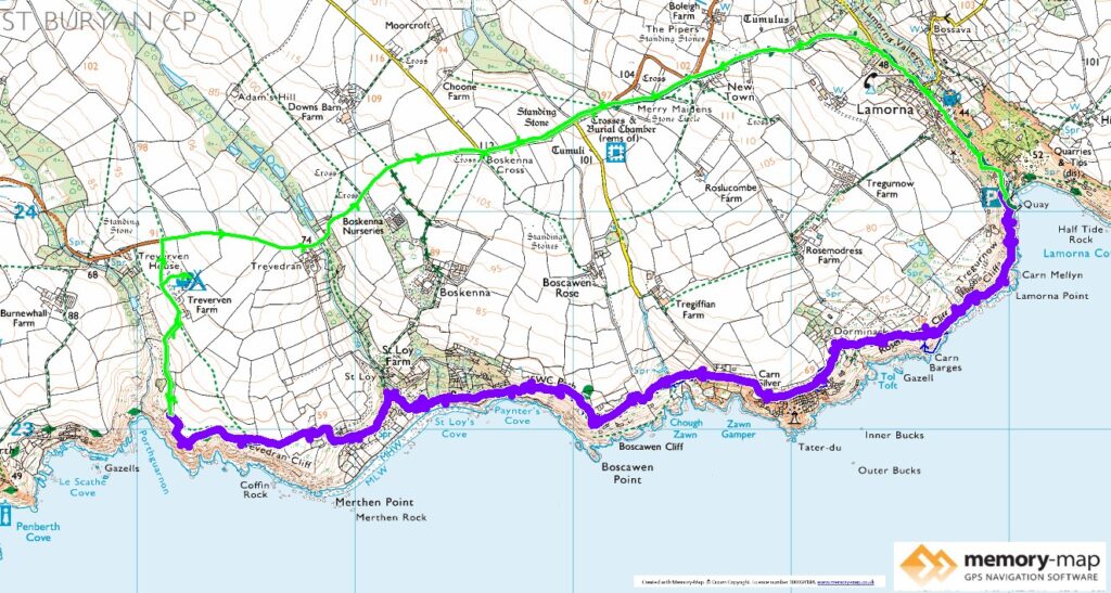
About half of section 29 in the SWCPA handbook
6.2km along the coast and 5.9 km inland
In last August, due to rain and shortage of time we had missed out this section, so as we were staying in Marazion for a couple of days, and the weather in March was much better that when we were here in August, we decided to complete this “missing link”.
There are a couple of small parking places on the B3315 which runs from Newlyn towards Porthcurno. So we parked just near the “Merry Maidens” a small circle of standing stones. Then walked past the stones and down a minor road, track to Larmorna Cove. It looked quite different from when were here in August and swam from the slipway at high tide.


It was now low tide, which exposed a small sandy beach, where some children were playing. Also a massive harbour wall presumably to shelter ships collecting stone.
The path follows the top of the harbour and then there is a warning sign saying that the next half-mile n of the path is strenuous and close to the cliff edge. They are not wrong – we had to climb over boulders whilst steadily climbing higher up the cliffs. It slowly levels out and becomes a more normal coastal walk.
After a while we could see the isolated Tater Du Lighthouse which I was surpises to learn was only built in 1965. A little further on the path descend to the sea and continues across boulders, but then there was a seat where we could have lunch in the sun and sheltered from the wind.

There are a couple of houses here at St Loy, with Camellias and Rhododendrons out with the last of the daffodils. Then a steady climb, sometimes enclosed by gorse and flowering blackthorne.

We continued to where we had walked down from Treverven Farm campsite in August and then followed the permissive way through the farm and then back along the road to the car.
