Almost half of 12 in the SWCPA handbook
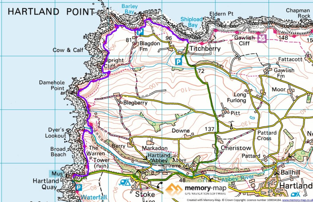
6.4 km along the coast and 5.9 km Iland
The forecast was good, and after checking out of our mobile home at Sandymouth, we drove back to the carpark at Hartlang Quay. From here the path lead back up to the Rocket house at the entrance to the car park, with spectacular views of the rock formations around Hartland Quay.
As we had come to expect it was not long before we descended almost to sea level to cross a stream then up again. The second valley had another long set of steps, but only 151 this time. After, I think, the third valley, we came across a plaque commemorating the sinking of a Hospital ship in 1918. This was where we could see the Hartland Point lighthouse for the first, and almost only time.
We continued around a radio installation, where we got another glimpse of the lighthouse, far below. There was a small carpark here and we were surprised and pleased to find a little café, where we had coffee. Then around a radar mast, and a sign saying there had been and early radar installation in the second war.
We stopped for lunch a little further along and told a couple of walkers that coffee was available not far away, which seemed to raise their spirits.
We left the path a little later and walked inland to East Titchberry form, where there is a small National Trust carpark. From there we followed some minor roads to Hartland Abbey, which was closed on Friday, and thence to Stoke and down to Hartland Quay.
Here we looked at the museum about the Quay and shipwrecks and had a cup of tea at the hotel. Then on to the Bush Inn at Morwenstow.