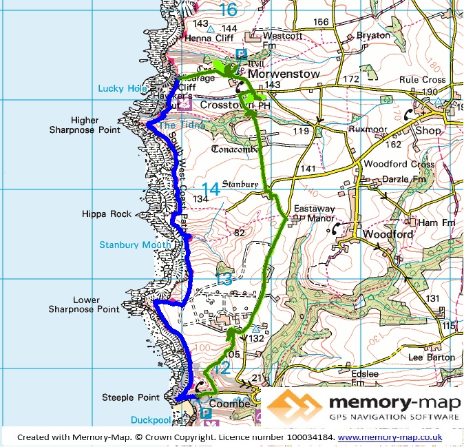
Part of section 13 in the SWCPA handbook
5.2 km along the coast and 6.8 km Inland
The forecast was quite good and so we drove the short distance from our mobile home at Sandymouth to Duckpool cottage and were surprised how may cars were already parked there. However after talking to a man with a clipboard, discovered that he was leading a “walk and talk” group from there.
So we set off, initially a steep, and long path, in the side of a grassy cliff. Eventually at the top there was a good level path to the dishes and ray-domes that we had seen all the way from Bude. Of course much larger when you get close.
There was a good, mostly level path and apart from just at the beginning, the double chain-link fence, complete with lights, cameras and razor wire was almost out of site.
After another descent and ascent, there was a dramatic ridge leading to Higher Sharpnose Point, and some brave people walking to the end, however we continued down to Tidna Shute, a dry river after the lack of rain this summer and then a steep uphill path back to the clifftop.
A little further along we took a path back inand initially to the church at Morwenstow, which had bench ends on the pews dating back to the 1500’s and then to the Pub – the Bush Inn. There is a tea room near the church and a green a little further along where there is the Pub – the Bush Inn. We stopped here for a drink in the garden and then had our sandwich on the Green.
After a little difficulty finding the start of a bridleway and a confused junction, we made our way back to the left of the radio dishes and the GCHQ entrance with the contrasting signs of “Welcome to GCHQ Bude” and “Prohibited ares under the National Security act….”
After following a track around the edge of the complex we found, with a little difficulty, a track back down to Duckpool cottage and our car.